Randonnée les cuveaux Éloyes Vosges
Randonnée les cuveaux Éloyes Vosges vendredi 1 mai 2026.
Randonnée les cuveaux Adultes A pieds Difficulté moyenne
Randonnée les cuveaux Près du transformateur 88510 Éloyes Vosges Grand Est
Durée : 120 Distance : 4300.0 Tarif :
Accès Depuis Remiremont, direction Epinal sortie Eloyes, traverser la Moselle, puis direction St-Etienne-les-Rt et le Frêne.
Parking Le Frêne (près du transformateur).
Distance 4,3 km Durée 2 h Dénivelé 140 m Balisage anneau rouge.
1) Prendre le chemin balisé en face entre deux clôtures de propriétés.
2) Plus haut, ignorer le sentier fléché direction les cuveaux et continuer vers la droite. Longer un clairière, puis un mur de pierre.
3) Au carrefour au dessus d’un petit chalet, prendre à gauche le chemin forestier de Groshaut (au bord de la petit route).
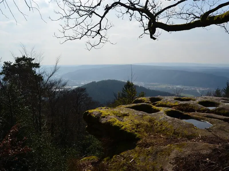
4) Avant le chalet, prendre à gauche en suivant le balisage. Faire l’aller/retour jusqu’au roches puis repartir sur la gauche jusqu’au belvédère.
5) Au belvédère, prendre le sentier caillouteux et balisé qui descend pour rejoindre la route qui redescend jusqu’au parking.
Difficulté moyenne
+33 3 29 62 23 70
Afficher la carte du lieu et trouvez le meilleur itinéraire
English :
Access From Remiremont, direction Epinal, exit Eloyes, cross the Moselle, then direction St-Etienne-les-Rt and Le Frêne.
Parking Le Frêne (near the transformer).
Distance 4,3 km Duration 2 h Difference in altitude 140 m Marking red ring.
1) Take the marked path in front of you between two property fences
2) Further up, ignore the signposted path direction les cuveaux and continue to the right. Go along a clearing, then a stone wall.
3) At the crossroads above a small chalet, turn left onto the forest road of Groshaut (at the edge of the small road).
4) Before the chalet, turn left following the signs. Go back and forth to the rocks and then turn left to the lookout
5) At the belvedere, take the stony and marked path that goes down to join the road that goes down to the parking.
Deutsch :
Anfahrt: Von Remiremont, Richtung Epinal Ausfahrt Eloyes, die Mosel überqueren, dann Richtung St-Etienne-les-Rt und Le Frêne.
Parkplatz: Le Frêne (in der Nähe des Transformators).
Entfernung: 4,3 km Dauer: 2 h Höhenunterschied: 140 m Markierung: roter Ring.
1) Nehmen Sie den markierten Weg gegenüber zwischen zwei Grundstückszäunen
2) Weiter oben ignorieren Sie den mit direction les cuveaux beschilderten Weg und gehen nach rechts weiter. Gehen Sie entlang einer Lichtung und dann an einer Steinmauer vorbei.
3) An der Kreuzung oberhalb eines kleinen Chalets biegen Sie links auf den Waldweg von Groshaut ab (am Rand der kleinen Straße).
4) Vor dem Chalet links abbiegen und der Markierung folgen. Gehen Sie hin und zurück bis zu den Felsen und dann wieder nach links bis zum Aussichtspunkt
5) Am Aussichtspunkt nehmen Sie den steinigen, markierten Weg, der nach unten führt, bis Sie die Straße erreichen, die wieder zum Parkplatz hinunterführt.
Italiano :
Accesso: Da Remiremont, direzione Epinal, uscita Eloyes, attraversamento della Mosella, direzione St-Etienne-les-Rt e Le Frêne.
Parcheggio Le Frêne (vicino al trasformatore).
Distanza: 4,3 km Durata: 2 h Dislivello: 140 m Segnaletica: anello rosso.
1) Prendere il sentiero segnalato di fronte tra due recinzioni di proprietà
2) Più in alto, ignorate il sentiero segnalato direction les cuveaux e proseguite a destra. Costeggiate uno spiazzo, poi un muro di pietra.
3) All’incrocio sopra un piccolo chalet, svoltare a sinistra sulla pista forestale del Groshaut (ai margini della stradina).
4) Prima dello chalet, svoltare a sinistra seguendo le indicazioni. Andate avanti e indietro fino alle rocce e poi girate di nuovo a sinistra fino al belvedere
5) Al belvedere, imboccare il sentiero sassoso segnalato per scendere alla strada che riporta al parcheggio.
Español :
Acceso: Desde Remiremont, dirección Epinal, salida Eloyes, cruzar el Mosela, luego dirección St-Etienne-les-Rt y Le Frêne.
Aparcamiento: Le Frêne (cerca del transformador).
Distancia: 4,3 km Duración: 2 h Desnivel: 140 m Señalización: anillo rojo.
1) Tome el camino marcado enfrente entre dos vallas de la propiedad
2) Más arriba, ignorar el camino señalizado direction les cuveaux y continuar a la derecha. Ir a lo largo de un claro, a continuación, un muro de piedra.
3) En el cruce que se encuentra por encima de un pequeño chalet, gire a la izquierda por la pista forestal de Groshaut (al borde de la pequeña carretera).
4) Antes del chalet, gire a la izquierda siguiendo las señales. Ve hacia adelante y hacia atrás hasta las rocas y luego vuelve a girar a la izquierda hasta el mirador
5) En el mirador, tomar el camino pedregoso marcado para bajar a la carretera que vuelve a bajar al aparcamiento.
Cet itinéraire a été mise à jour le 2025-01-30 par Système d’information touristique Lorrain