Sentier du bois du Malaumont Mattaincourt Vosges
Sentier du bois du Malaumont Mattaincourt Vosges vendredi 1 mai 2026.
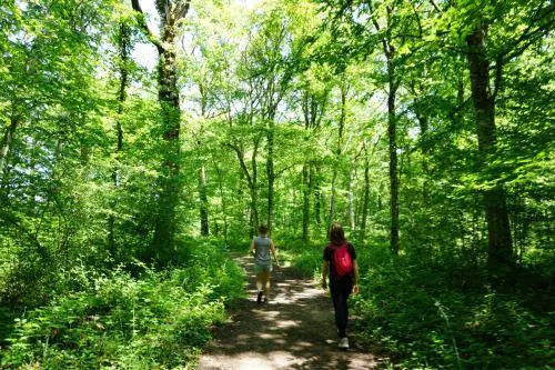
Sentier du bois du Malaumont Adultes Avec une poussette Facile
Itinéraire de promenade et de randonnée, PR Sentier du bois du Malaumont 88500 Mattaincourt Vosges Grand Est
Durée : 70 Distance : 3500.0 Tarif :
Départ chemin entre Mattaincourt et Bazoilles-et-Ménil
Distance 3,5 km
Temps moyen 1h10
Balisage rond jaune FFRandonnée
Ce sentier vous propose la découverte du bôs ( bois en patois vosgien) local. Itinéraire recommandé aux enfants, invitation à découvrir la vie de la forêt.
Sentier réalisé en collaboration avec la Communauté de Communes Mirecourt Dompaire et l’Astragale
1. Au panneau d’information, prendre le chemin principal sur environ 400 m.
2. Monter sur la droite, puis, à gauche, passer la barrière vers l’arboretum ;le traverser.
3. A la sortie de l’arboretum, s’engager à droite sur le chemin forestier. Atteindre un embranchement.
> A droite, l’itinéraire (en tirets sur la carte) est conseillé aux personnes à mobilité réduite.
4. Prendre à gauche pour la suite du sentier (terrain difficile). Arrivé à proximité de la clairière, prendre à droite. Continuer sur environ 150 m et suivre le chemin sur la gauche.
5. Bifurquer à droite, longer une zone en partie déboisée sur environ 150 m, puis se diriger vers la gauche. Descendre la pente (passage sur une première passerelle).
6. En bas, tourner à droite. Suivre le petit ruisseau (attention ! terrain encaissé, risque de chute), puis monter à droite.
7. Après une longue montée, tourner à gauche puis de suite à droite pour reprendre le chemin (passage sur la seconde passerelle). Continuer la montée
8. S’engager à gauche sur un chemin plus petit. Poursuivre pour revenir au parking de départ.
Sentier et rando fiche réalisé par la Fédération Française des Randonnées Pédestres
Facile
https://vosges.ffrandonnee.fr/ +33 6 61 69 69 35
Afficher la carte du lieu et trouvez le meilleur itinéraire
English :
Departure path between Mattaincourt and Bazoilles-et-Ménil
Distance: 3.5 km
Average time: 1h10
Round yellow FFRandonned beaconing
This trail offers you the discovery of the local bôs ( wood in Vosges patois). This itinerary is recommended for children, an invitation to discover the life of the forest
Path realized in collaboration with the Community of Communes Mirecourt Dompaire and the Astragale
1. At the information board, take the main road for about 400 m.
2. Go up on the right, then, on the left, pass the barrier towards the arboretum ; cross it
3. At the exit of the arboretum, turn right onto the forest road. Reach a fork in the road.
> To the right, the route (in dashes on the map) is recommended for people with reduced mobility.
4. Turn left for the rest of the trail (difficult terrain). When you reach the clearing, turn right. Continue for about 150 m and follow the path on the left
5. Turn right, drive along a partly cleared area for about 150 m, then turn left. Go down the slope (passing over a first footbridge).
6. At the bottom, turn right. Follow the small brook (caution! steep terrain, risk of falling), then climb to the right
7. After a long ascent, turn left and then immediately right to take the path again (passing over the second footbridge). Continue the climb
8. Go left on a smaller path. Continue to return to the parking lot
Trail and hike sheet produced by the French Federation of Hiking Trails
Deutsch :
Start: Weg zwischen Mattaincourt und Bazoilles-et-Ménil
Entfernung: 3,5 km
Durchschnittliche Zeit: 1 Std. 10 Min
Markierung runder gelber Kreis FFRandonnée
Dieser Weg bietet Ihnen die Möglichkeit, das lokale Bôs (Holz) im Patois Vosgien zu entdecken. Der Weg wird für Kinder empfohlen und lädt dazu ein, das Leben im Wald zu entdecken
Dieser Pfad wurde in Zusammenarbeit mit der Communauté de Communes Mirecourt Dompaire und L’Astragale erstellt
1. An der Informationstafel nehmen Sie den Hauptweg für ca. 400 m.
2. Gehen Sie rechts hinauf und dann links an der Schranke zum Arboretum vorbei ;durchqueren Sie es
3. Am Ende des Arboretums biegen Sie rechts in den Waldweg ein. Sie kommen an eine Abzweigung.
> Der Weg (auf der Karte gestrichelt) ist für Personen mit eingeschränkter Mobilität geeignet.
4. Biegen Sie links ab, um den Weg fortzusetzen (schwieriges Gelände). In der Nähe der Lichtung angekommen, biegen Sie rechts ab. Gehen Sie etwa 150 m weiter und folgen Sie dem Weg auf der linken Seite
5. Rechts abzweigen, ca. 150 m an einem teilweise abgeholzten Bereich entlanggehen und dann nach links gehen. Gehen Sie den Hang hinunter (über einen ersten Steg).
6. Unten angekommen, biegen Sie rechts ab. Dem kleinen Bach folgen (Vorsicht! eingeschnittenes Gelände, Absturzgefahr), dann rechts hinauf
7. Nach einem langen Anstieg biegen Sie links und dann gleich wieder rechts ab, um den Weg wieder aufzunehmen (über die zweite Fußgängerbrücke). Weiter bergauf
8. Links in einen kleineren Weg einbiegen. Weitergehen, um zum Startparkplatz zurückzukehren
Sentier et rando fiche réalisé par la Fédération Française des Randonnées Pédestres (Französischer Wanderverband)
Italiano :
Partenza: sentiero tra Mattaincourt e Bazoilles-et-Ménil
Distanza 3,5 km
Tempo medio: 1h10
Marcatura rotonda gialla FFRandonnée
Questo percorso vi offre l’opportunità di scoprire il bôs locale ( bosco in dialetto dei Vosgi). Consigliato ai bambini, un invito a scoprire la vita della foresta
Questo percorso è stato realizzato in collaborazione con la Communauté de Communes Mirecourt Dompaire e l’Astragale
1. Al pannello informativo, prendere il sentiero principale per circa 400 m.
2. Salite a destra e poi a sinistra attraverso il cancello dell’arboreto; attraversatelo
3. Alla fine dell’arboreto, svoltare a destra sulla pista forestale. Raggiungete un bivio.
> A destra, l’itinerario (tratteggiato sulla mappa) è consigliato alle persone con mobilità ridotta.
4. Girare a sinistra per il resto del sentiero (terreno difficile). Quando si raggiunge la radura, girare a destra. Proseguire per circa 150 m e seguire il sentiero a sinistra
5. Si devia a destra, si costeggia un’area parzialmente sgombra per circa 150 m, poi si va a sinistra. Scendere lungo il pendio (superando una prima passerella).
6. In fondo, girare a destra. Seguire il piccolo ruscello (attenzione! terreno ripido, rischio di caduta), quindi salire a destra
7. Dopo una lunga salita, svoltate a sinistra e poi a destra per riprendere il sentiero (oltre la seconda passerella). Continuare la salita
8. Svoltate a sinistra su un sentiero più piccolo. Proseguire per tornare al parcheggio di partenza
Scheda dei sentieri e delle escursioni realizzata dalla Fédération Française des Randonnées Pédestres
Español :
Inicio: camino entre Mattaincourt y Bazoilles-et-Ménil
Distancia 3,5 km
Tiempo medio: 1h10
Marcas redondas amarillas de la FFRandonnée
Este sendero le ofrece la oportunidad de descubrir el bôs ( bosque en dialecto de los Vosgos) local. Recomendado para niños, una invitación a descubrir la vida del bosque
Este sendero fue creado en colaboración con la Communauté de Communes Mirecourt Dompaire y el Astragale
1. En el panel de información, tome el camino principal durante unos 400 m.
2. Sube a la derecha y luego a la izquierda por la puerta del arboreto; crúzala
3. Al final del arboreto, gire a la derecha por la pista forestal. Llegar a una bifurcación del camino.
> A la derecha, el itinerario (punteado en el mapa) está recomendado para personas con movilidad reducida.
4. Gire a la izquierda para el resto del camino (terreno difícil). Cuando llegue al claro, gire a la derecha. Continúe unos 150 m y siga el camino de la izquierda
5. Bifurcarse a la derecha, caminar por una zona parcialmente despejada durante unos 150 m, y luego dirigirse a la izquierda. Bajar la pendiente (sobre una primera pasarela).
6. Al final, gire a la derecha. Siga el pequeño arroyo (¡cuidado! terreno empinado, riesgo de caída), luego suba a la derecha
7. Después de una larga subida, gire a la izquierda y luego a la derecha para tomar de nuevo el camino (sobre la segunda pasarela). Continúa el ascenso
8. Gire a la izquierda por un camino más pequeño. Continúe para volver al aparcamiento de salida
Hoja de ruta y senderismo elaborada por la Fédération Française des Randonnées Pédestres
Cet itinéraire a été mise à jour le 2025-05-19 par Système d’information touristique Lorrain